Hunting Available In the Delaware Water Gap National Recreation Area Region
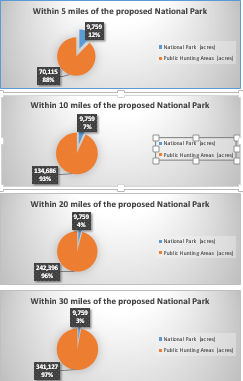
To address the concerns of those who say that the proposed National Park will take away a significant amount of hunting land, we have prepared a map of the public hunting areas available within 30 miles of the proposed National Park boundaries. The map shows that the proposed National Park is a small part of the current National Recreation Area and a VERY small part of the abundant public land available for hunting in this region.

The map below displays public hunting grounds available outside the proposed National Park (shown in yellow). It shows hunting available within 5, 10, 15, 20 and 30 miles of the boundary of the proposed National park. Each of the public agencies that have jurisdiction of these hunting areas are identified by a different color and are listed in the map’s legend.
Note: This map does not include private hunting land (farms, hunting clubs, large private holdings). It also does not include land where hunting is permitted on a more restricted basis such as municipal, county and land conservancy properties.
Map of Public Hunting Land
The charts below compare the acreage of the proposed National Park (no hunting) to the amount of available public hunting land.
Map of public hunting land within the borders of Sandyston Township
Sandyston Township (NJ) residents have raised concerns about how the proposed National Park will affect access to local hunting. The map below shows the proposed National Park in yellow. Each agency that has jurisdiction over the open space in the township is shown by a different color in the legend.
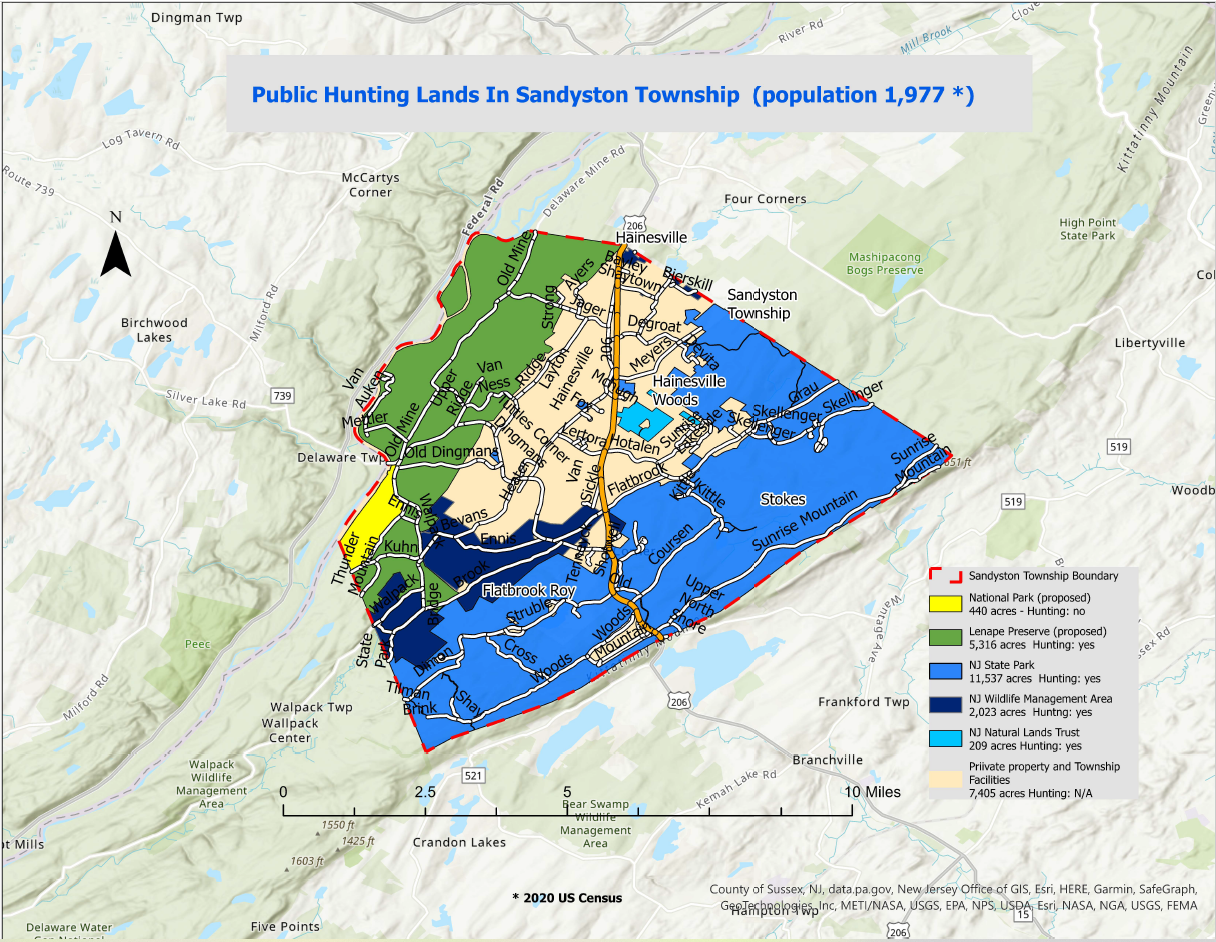
The chart below shows that the proposed National Park will not permit hunting on 440 acres or 2% of the land in Sandyston Township. This is a small fraction of the 19,085 acres of public open space that will allow hunting or 71% of the land in Sandyston Township.
